
When it comes to rainforests, collecting data isn’t always an easy task, and researchers or scientists need data fast to understand how forests are changing due to climate change and deforestation.
Traditionally, rainforest regeneration has been monitored manually. This requires skilled, knowledgeable people and specialized equipment, and can be especially challenging if the land is difficult to access.
So, how to solve this? It can take more than a year on foot for a research team to get a big picture view of a forest canopy, but not anymore and not for a while now.
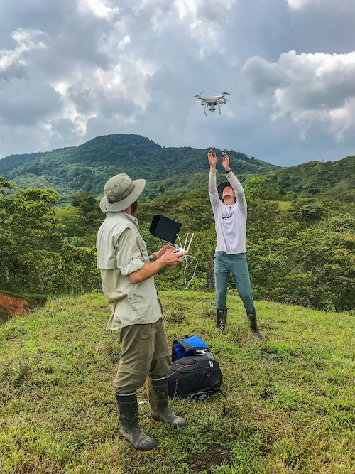
The answer to the question is drones. Drones can capture in just a few days a lot of high-resolution images fast, making it plausible to monitor deforestation, assess biodiversity, track trends and changes over time, study leaf phenology, look at wildlife abundance and distribution, map landscape or even individual trees.
In some areas of the world, like in the Brazilian Amazon, researchers are training indigenous communities to map forest resources, so they can make sure they are harvesting sustainably, or to zone for fire risk and monitor forest fires and deforestation from a safe distance.
The low-cost, high success rate of a drone is drawing a promising picture for conservation mapping and monitoring, and could mean large savings for conservation workers and researchers. And if that wasn’t enough, little drones run on batteries, which could translate to a large decrease in the carbon footprint of the conservation studies themselves.
However, most researchers might agree that drones should complement work done on the ground, not replace it, stating that there’s nothing better than being there on the ground close to what you’re studying.
At the Mamoní Valley Preserve, we have been cataloging the Alliance’s land holdings and collecting data on various species throughout the Valley, including research work with the University of Redlands, and their “Panamapping”, where field research and drones are used to map watershed boundaries, stream courses, riparian habitat and trails in the Mamoní Valley, to classify them according to vegetative structure and potential for carbon sequestration.

Leave a Reply